Ba Son Bridge (Cầu Thủ Thiêm 2)
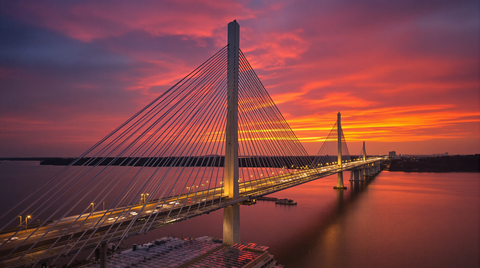
A 1,465-metre asymmetrical cable-stayed road bridge over the Saigon River, completing the most direct vehicle route between central District 1 (Tôn Đức Thắng Street) and the Thu Thiem New Urban Area. Inaugurated 28 April 2022 after seven years of construction by Đại Quang Minh JSC; renamed from "Thu Thiem 2 Bridge" to "Ba Son Bridge" by the HCMC People's Council in 2023.
- Official names
- Ba Son Bridge / Cầu Thủ Thiêm 2
- Type
- Asymmetrical cable-stayed
- Total length
- 1,465 m
- Main bridge
- 885 m
- Width
- 27 m (6 lanes)
- Main pylon
- 113 m (dragon-shaped)
- Cable system
- 56 stay cables
- Investor
- Đại Quang Minh JSC
- Total investment
- ~3,100 billion VND
- Groundbreaking
- February 2015
- Inauguration
- 28 April 2022
- Estimated daily traffic
- ~60,000+ vehicles
Ba Son Bridge technical specifications
Ba Son Bridge is a single-pylon asymmetrical cable-stayed road bridge. The structural type is uncommon in Vietnam — the asymmetry concentrates the cables on one side of the pylon, giving the bridge its distinctive silhouette and reducing the structural footprint on the District 1 bank where the historic Ba Son Shipyard land was under sensitive redevelopment.
Dimensions
- Total length: approximately 1,465 metres, including approach viaducts on both banks.
- Main bridge length: 885 metres, comprising the cable-stayed main span and back-spans.
- Deck width: 27 metres, accommodating six traffic lanes plus dedicated cycle and pedestrian lanes.
- Pylon height: 113 metres above water level, designed as a stylised dragon shape — a deliberate reference to Vietnamese cultural iconography and HCMC's "Dragon City" identity.
- Stay cable count: 56 cables in a single-plane asymmetrical arrangement.
Investment & delivery
- Investor: Đại Quang Minh Real Estate Investment JSC [3], the Vietnamese developer behind Sala Township.
- Total capital: approximately 3,100 billion VND [5] (approximately 130 million USD at 2022 exchange rates).
- Delivery mechanism: Build-Transfer (BT) arrangement — Đại Quang Minh built the bridge in exchange for land in Thu Thiem, which became Sala Township.
- Groundbreaking: February 2015.
- Inauguration: 28 April 2022 [1]. Construction period: approximately seven years.
Historical significance of the Ba Son name
The bridge was planned and constructed under the project name Cầu Thủ Thiêm 2 (Thu Thiem 2 Bridge), the second of four planned Thu Thiem river crossings. In 2023, the Ho Chi Minh City People's Council adopted a resolution to formally rename the structure Cầu Ba Son [1] (Ba Son Bridge), tying it to the historic Ba Son Shipyard on the District 1 landing.
The Ba Son Shipyard was established in 1790 under the Nguyễn dynasty [2], expanded under French colonial administration as the Arsenal de Saïgon, served as the primary naval shipbuilding facility for the Republic of Vietnam, and continued operating as a state shipyard after 1975 until its closure and relocation in 2016 to make way for redevelopment. By naming the bridge after the shipyard, the HCMC People's Council preserved a cultural anchor that would otherwise have been lost when the site transitioned to mixed-use property development. The naming choice is widely covered in local Vietnamese media — see for example coverage in Tuổi Trẻ and VnExpress.
Use of both names
As of 2026, both names remain in active use:
- Cầu Ba Son — the official municipal name, used in HCMC government documents and street signage.
- Cầu Thủ Thiêm 2 / Thu Thiem 2 Bridge — the original planning name, still common in real-estate marketing, technical reference, English-language press, and master plan documents that pre-date the rename.
Urban planning & connectivity analysis
Ba Son Bridge is the structural piece that turned Thu Thiem from "across the river" into "across the bridge." Before April 2022, the only direct car routes between central District 1 and Thu Thiem were:
- The Thu Thiem Tunnel — landing in the south of the peninsula, suitable for Sala / FA5 / FA6 destinations but circuitous for FA1 and northern FA2a.
- Cầu Thủ Thiêm 1 (Bridge 1) — further north, primarily serving the Bình Thạnh / Bình Khánh routing.
Ba Son Bridge added a third option, and crucially the shortest one for the highest-density traffic flow: District 1 CBD (Tôn Đức Thắng) ↔ Thu Thiem master plan central spine (Trần Bạch Đằng / Arc Avenue). This is the route that serves Empire City, The Metropole Thu Thiem, The River, and most of the FA1 / FA2a residential cluster.
Estimated commute impact
From the District 1 side of the bridge to Empire City at off-peak hours: approximately 4–6 minutes by car. From the same starting point to Sala Township entrance: approximately 8–10 minutes. Peak-hour commute time is approximately 2x off-peak. The bridge therefore brought northern and central Thu Thiem inside a five-to-ten-minute commute envelope from District 1 — a transformative change for the residential and commercial proposition.
Traffic relief on other routes
Since opening, Ba Son Bridge has materially reduced congestion on the Thu Thiem Tunnel approach corridor, which had been the only dedicated direct car route through District 2 before 2022. Tunnel traffic remains heavy, but tunnel approach delays at the District 1 landing have measurably improved. Cầu Thủ Thiêm 1, which had previously seen heavy through-traffic seeking the Bình Thạnh detour, has likewise benefited from the alternative route.
Estimated daily traffic flow
The following chart shows our estimate of hourly vehicle flow across Ba Son Bridge on a typical weekday, derived from observation and publicly reported peak-hour throughput data. Total estimated daily flow: ~62,000 vehicles, comfortably below the design capacity. Hover any hour for the volume estimate.
Vehicle mix
By vehicle count, motorbikes dominate at roughly three-quarters of all crossings — consistent with HCMC city-wide modal share. Cars contribute approximately 22 percent of count but a much larger share of lane occupancy. Buses, light trucks and other vehicles make up the remaining 3 percent. Bicycles and pedestrians are accommodated on dedicated lanes outside the main carriageway and are not included in the figure.
Architectural design notes
The asymmetrical single-pylon configuration was selected to minimise the structural footprint on the District 1 bank, where the bridge lands inside the redeveloping Ba Son Shipyard parcel. A symmetrical two-pylon design would have required a back-span pylon either inside the shipyard area or further inland into central District 1 — both of which would have presented significant land-acquisition and heritage-preservation challenges.
The pylon's dragon shape is functional as well as symbolic: the form was tested in wind-tunnel simulation and selected for aerodynamic performance under HCMC's typhoon-belt wind loadings, with the silhouette reflecting Vietnamese cultural iconography and the official HCMC nickname "Dragon City."
Real-estate impact
From the day the bridge opened in April 2022, primary-market launch prices in northern Thu Thiem residential — Empire City in particular — were repriced upward to reflect the new commute envelope. Secondary-market resale prices at The River Thu Thiem and Sala Township followed. Asking rents at The Metropole Thu Thiem were calibrated around the new commute story from the project's first launches. Our investment guide covers the structural pricing thesis in detail.
Sources & further reading
- Ho Chi Minh City government portal — official HCMC People's Committee and People's Council resolutions including the 2023 bridge-naming decision. ↩
- Wikipedia — Ba Son Shipyard — historical context for the shipyard whose heritage the bridge name preserves. ↩
- Đại Quang Minh Corporation — primary investor / contractor official website with project timeline. ↩
- Tuổi Trẻ Online — Vietnamese-language press coverage of the inauguration, naming decision, and observed traffic data. ↩
- VnExpress — coverage of construction milestones, investment figures, and post-opening operations. ↩
- Wikidata — Cầu Ba Son (Q113023116) — structured data entity for cross-referencing.
- Wikipedia — Thu Thiem 2 Bridge — English-language encyclopaedia article.
Ba Son Bridge FAQs
What is the official name of Thu Thiem 2 Bridge?
The bridge has been officially renamed Cầu Ba Son (Ba Son Bridge) by the Ho Chi Minh City People's Council in a 2023 resolution. The original planning and project name Cầu Thủ Thiêm 2 (Thu Thiem 2 Bridge) is still widely used in technical, real-estate and English-language documentation; both names refer to the same structure.
Why was Thu Thiem 2 Bridge renamed Ba Son?
The new name honours the historic Ba Son Shipyard, founded in 1790, which occupied the District 1 landing site of the bridge for more than two centuries. The Ba Son shipyard was a major naval and commercial shipbuilding facility through French colonial, South Vietnamese, and post-1975 periods. By naming the bridge after the shipyard, the HCMC People's Council preserved the cultural memory of the site as it transitions to a mixed-use real-estate development.
How big is Ba Son Bridge?
The structure spans 1,465 metres in total length, with the main cable-stayed span measuring 885 metres. The deck is 27 metres wide and carries six traffic lanes (three in each direction) plus dedicated cycle and pedestrian lanes. The single dragon-shaped pylon rises 113 metres above the deck and supports 56 stay cables in an asymmetrical arrangement.
Who built and financed Ba Son Bridge?
Construction was led by Đại Quang Minh Real Estate Investment JSC, a Vietnamese property developer that also developed Sala Township in Thu Thiem. The total investment was approximately 3,100 billion VND (around 130 million USD at 2022 exchange rates), funded as part of a build-transfer arrangement under which Đại Quang Minh received land in Thu Thiem in exchange for delivering the bridge to the HCMC government.
When did Ba Son Bridge open to traffic?
The bridge was inaugurated on 28 April 2022 in a ceremony attended by HCMC People's Committee leadership. Construction had begun in February 2015 [3], giving a total build period of approximately seven years — significantly extended by site conditions, design refinements, and pandemic-era disruption.
How much traffic does Ba Son Bridge carry per day?
Recent observed flows estimate roughly 60,000 to 80,000 vehicles per day [4] across the structure, with strong morning (07:00–09:00) and evening (17:00–19:00) peaks reflecting District 1 commuter patterns. Motorbikes account for the dominant share by vehicle count; cars contribute a much smaller share by count but a much larger share by lane-occupancy. The bridge was designed with substantial spare capacity over current loads.
How does Ba Son Bridge change connectivity?
Ba Son Bridge created the most direct vehicle route between central District 1 (Tôn Đức Thắng Street) and Thu Thiem (Trần Bạch Đằng Street / Arc Avenue, the master plan central spine). Prior to the bridge's opening, the only direct car routes were the Thu Thiem Tunnel (further south) and Cầu Thủ Thiêm 1 (further north toward Bình Thạnh). The new bridge cut peak-hour travel time between the District 1 CBD and northern Thu Thiem by an estimated 12–18 minutes versus pre-2022 routings, materially improving the commercial proposition of Empire City, Sala, The River and the surrounding parcels.